
Mile markers start at the trailhead at the parking area off Northgate road and increase if you are going in the counterclockwise direction looking down from the sky. Notes below ASSUME you are going in CCW direction. This is not a comprehensive list of all the road crossings but shows the most obvious places to get lost. (Follow your nose at all the other areas. If you go in the clockwise direction however, there are a couple of places where your nose might fail you.) Most of the trail has small markers with arrows to show you the main loop.

(Image courtesy of Argonne Running Club.)
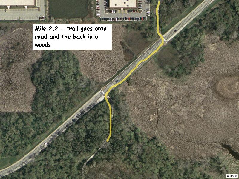 The trail goes onto Westgate Road for about 100 meters. Turn right onto shoulder of the road and then left again onto the trail. (In this picture, you are coming down the trail from top of image.) |
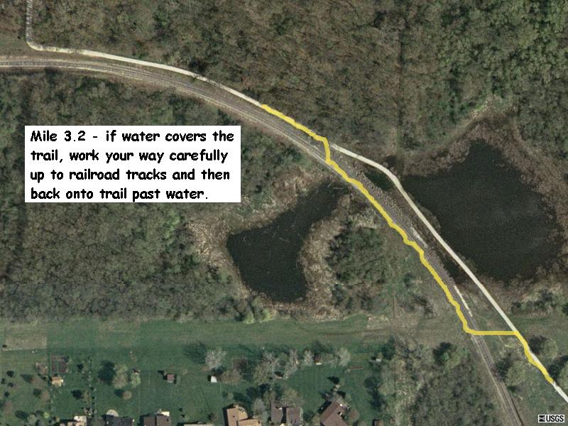 During or after very wet weather, a section of the trail may be water covered. You can carefully work your way up to the railroad tracks and go around the flooded section. Please do NOT try to run on the track bed. It is very rocky and uneven. |
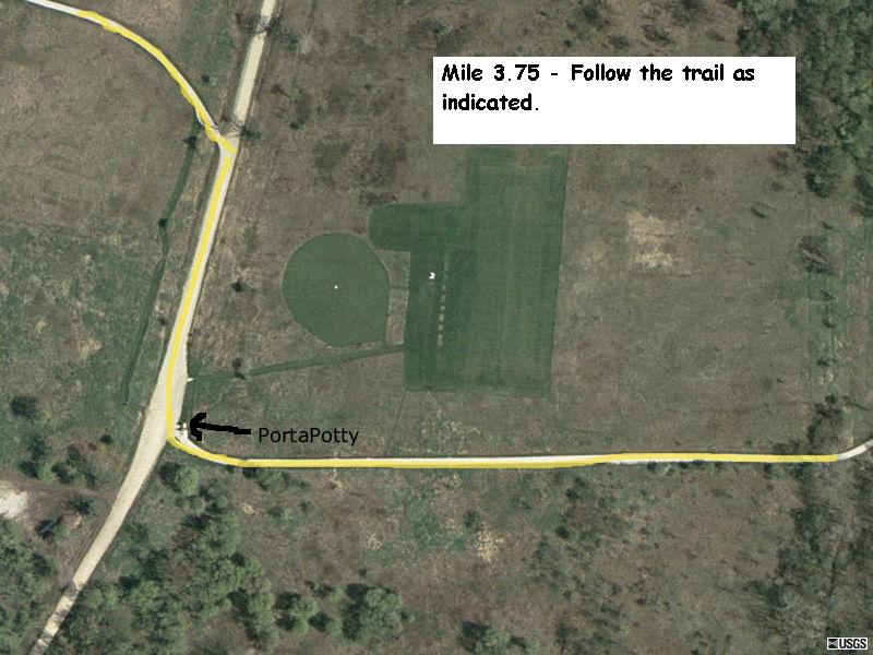 Near the model airplane field, the trail intersects a gravel road. Turn right onto the road and then left back onto the trail in about 100 meters. There is normally a portapotty at this location. (In this picture, you are coming from the upper left and exiting on the right.) |
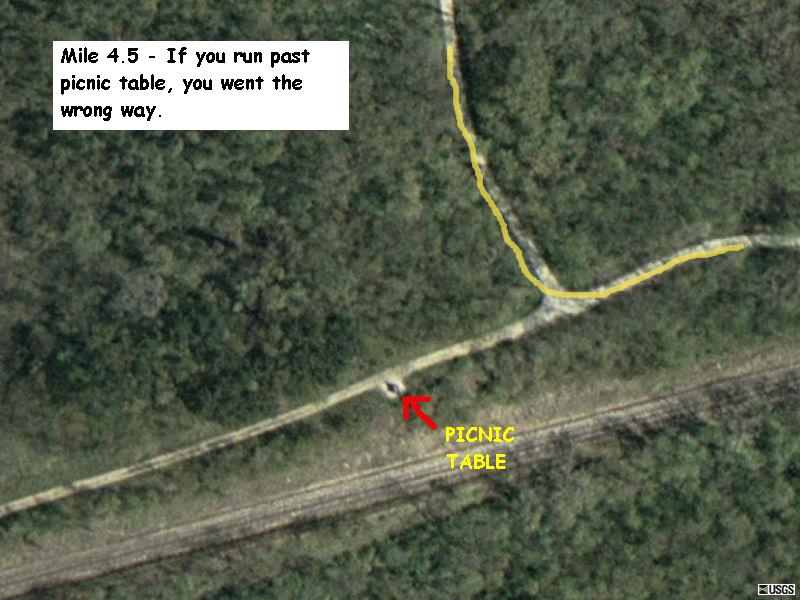 At about mile 4.5, the trail T's into another. Turn left. If you go right, you will see a small sheltered picnic table. (In this picture, you are coming down the trail from top of image.) |
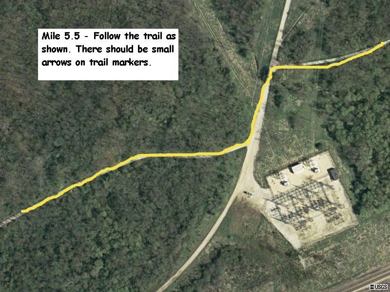 At mile 5.5, the trail runs into another dirt road. Take a left and then a right back onto trail. (In this picture, you are entering from the left and exiting on the right.) |
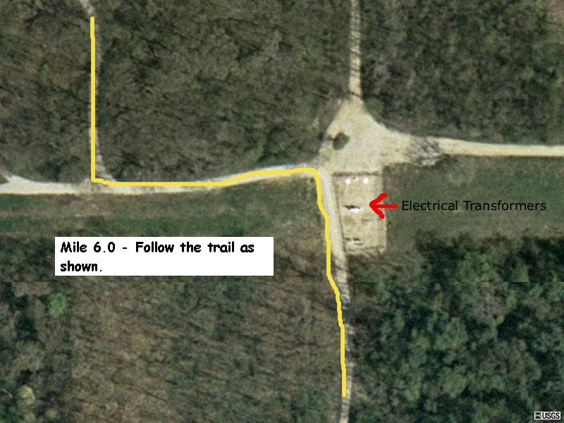 At mile 6, you go up a steep hill (ugh). At the top is a set of electrical transformers. Take a left here and then soon a right. (In this picture, you are entering from the bottom of the image and exiting at the top.) |
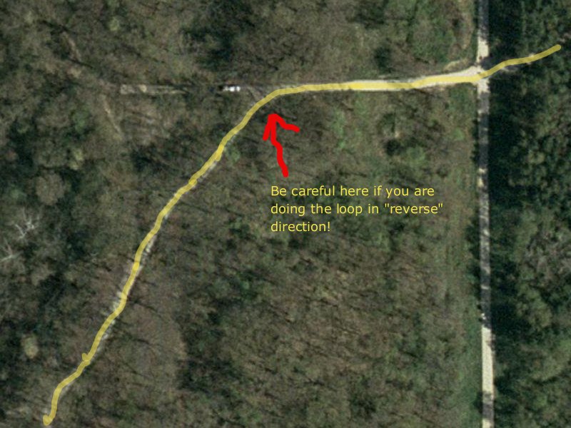 At mile 6.3, there is a fork in trail that is not a problem if you running in the ccw direction. But if you are running clockwise, you have to curve to the left at the fork. |
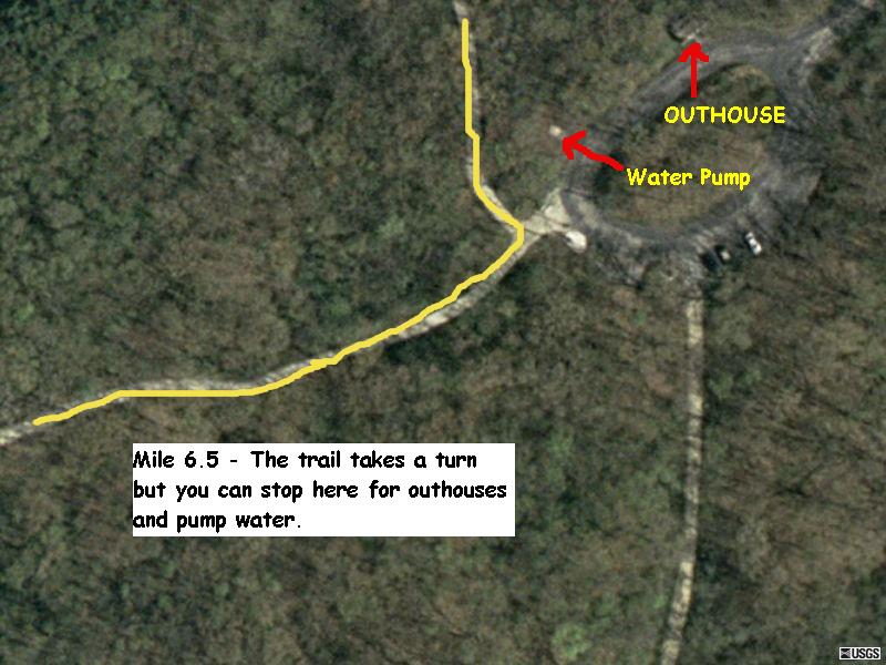 At mile 6.5, the trail takes an obvious left turn. In front of you at the turn is a parking area with outhouses and a hand pumped well. (In this picture, you are entering from left and exiting at the top.) |
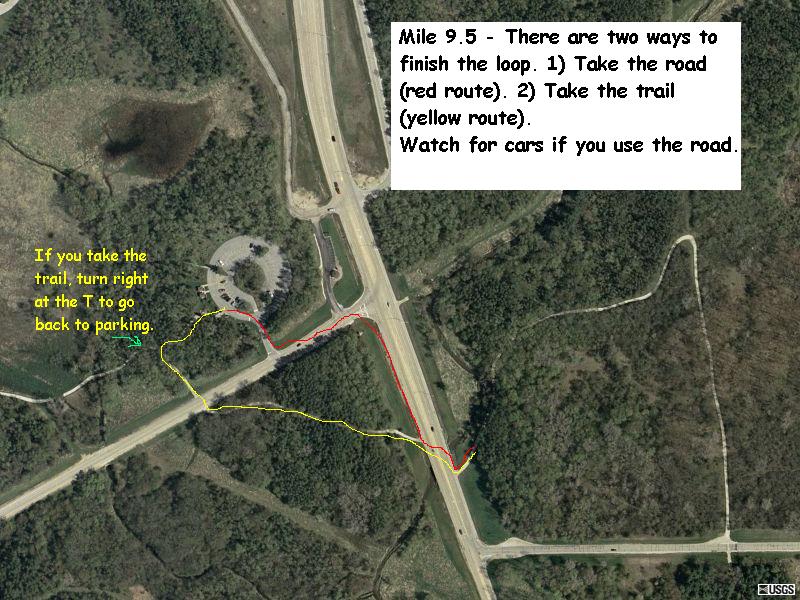 At the very end of loop, you can take shoulder of road back to parking area but be careful of cars! If you cross the road angling to your right, you can also take the trail a little farther in which case you will cross Northgate Road and then T back into trail from parking lot. If you don't turn right here, you will do the loop again! (In this picture, you are coming from the trail system on the right.) |